Downloads
| File | Availablity |
|---|---|
| Europe wTerrainHexes_WEST | after purchase |
| Europe wTerrainHexes_EAST | after purchase |
| Europe wTerrainHexes_FINAL | after purchase |
Asset Types
- PNG
Vitals
| Designer | McDoffer Games |
|---|---|
| Version | 1.0 |
| License | Commercial Use |
| Category | Board Templates |
| Tags | War Civilization |
European Hex Map
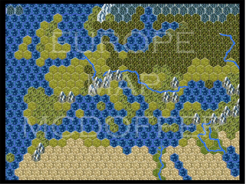
This image features a huge 587 hex map of Europe, the Middle East and North Africa.
Preview
Description
This board template features a 587 hex map of Europe, the Middle East and North Africa. The dimensions of each hex in its native size is approx 440 x 390 pixels (1.375" x 1.25"). Each hex is slightly larger than a mini-hex tile. Full image is 10950 x 8175 pixels.
Full image is 10950 x 8175 pixels. In it's native size, this map would best be printed on a two 6-fold game boards, but can be resized to fit any board. Included is the full file as well as eastern and western portions of the template, each of which can be used directly in a bi-fold board.
Perfect for classical, Roman era, WWII or any European setting.
The main European landmass north of Turkey and west of Russia has been enlarged about 15% to allow more playable space.
* Updated Nov 20 2018 * Added major European rivers.
If you wish to purchase a physical copy of this map, please see this link: European Hex Boards


